
Mirna Manteca
El sonido de la grava debajo de nuestros neumáticos aumenta conforme nos detenemos.
Abro la puerta, tomo mi regla de la guantera y salgo del auto. Espero que mi chaleco de seguridad atraiga la atención de los conductores y me mantenga a salvo.
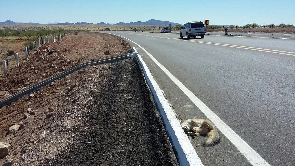
Me acerco al bulto de piel y pelo que descansa sobre el asfalto caliente. ¿Qué es? El color del pelaje es gris plateado, tonos rojizos, la morfología de las patas indica que es canino. Urocyon cinereoargenteus, el zorro plateado ceniciento, comúnmente conocido en la región como la zorrita gris.
Coloco mi regla en el suelo y tomo las fotos necesarias. Tomo coordenadas y subo la observación a la base de datos con la aplicación de mi teléfono. El cuerpo está entero, la cara intacta, con ojos bien abiertos parece que me miran directamente.
Mi corazón se rompe.
© Sky Island Alliance/Wildlands Network
Los monitoreos de fauna atropellada no son divertidos. Sin embargo, proporcionan información valiosa. ¿Dónde están los animales cruzando nuestras carreteras? ¿Dónde deberían los conservacionistas abogar por pasos de fauna silvestre y cercado de inducción?
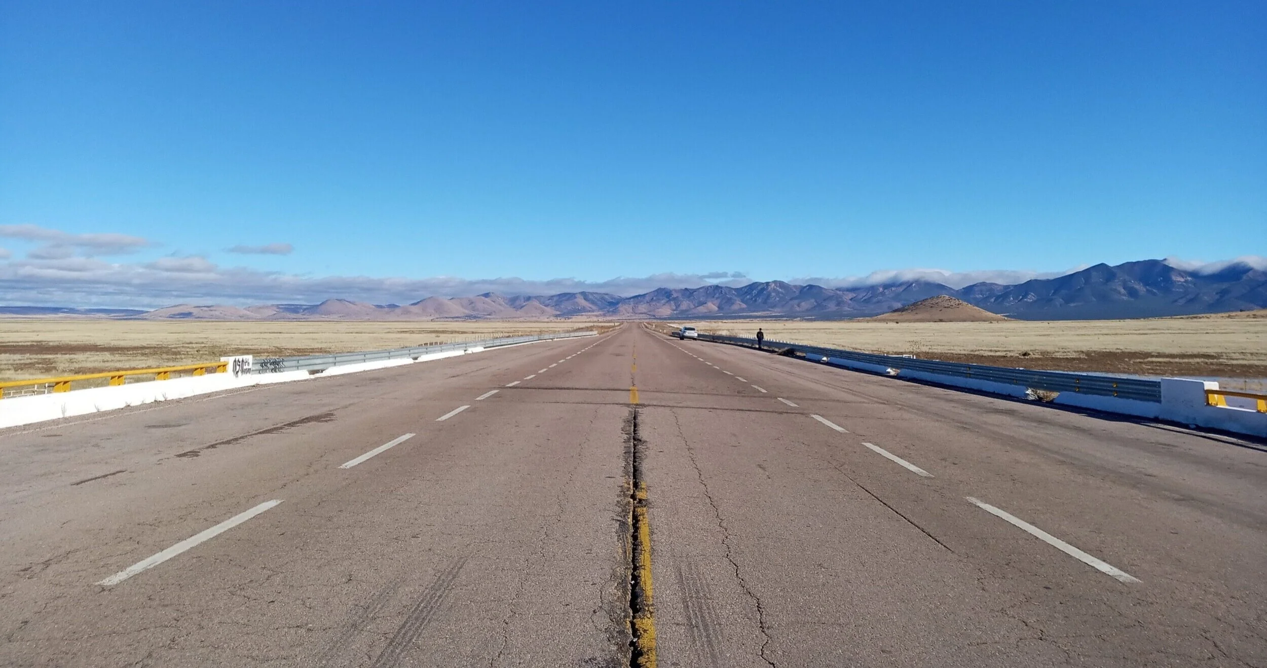
Se estima que más de 2000 animales son atropellados por vehículos cada año en la Carretera Federal 2 de México en el tramo Ímuris – límite de estado Sonora / Chihuahua. Esta es una carretera que corre desde la ciudad de Tijuana hasta Matamoros, paralela al muro fronterizo en algunos tramos.
Tuve suerte de dirigir los esfuerzos de monitoreo de aptropellos y participar en este proyecto mientras trabajaba para Sky Island Alliance (SIA), una organización binacional que trabaja para proteger y restaurar la región de las Islas Serranas en el noreste de Sonora, México y el sureste de Arizona, EEUU.
Pudimos recopilar dos años de datos de atropellos en 48 recorridos de 250 Km, más de 350 cadáveres evaluados. Esta información está disponible en el proyecto iNaturalist de SIA, Sky Island Nature Watch, imágenes sangrientas y todo.
El Proyecto de la Carretera Federal 2 está liderado por Wildlands Network, una organización internacional que trabaja para conectar la fauna silvestre de América del Norte. Actualmente trabajo como Coordinadora de Ecología Vial para su Programa en México, donde lidero este mismo proyecto.
Mentiría si dijera que soy una científica fuerte, y que nunca lloré durante los recorridos en carretera. Lloré muchas veces. Pero tengo la esperanza de que los datos que recopilamos conducirán a cosas buenas que se extenderán por todo el estado, el país.
Unos 100 metros más adelante puedo ver otro bulto de pelo en la carretera. ¿Qué será?
mirna@wildlandsnewtork.org
The sound of gravel increases under our tires as we pull over.
I open the door, grab my ruler from the glove compartment, and get out of the car. My bright orange vest hopefully catches the truck driver’s eye and keeps me somewhat safe.
I walk up to the lump of fur laying on the hot asphalt. What is it? The color of the fur is a silver-gray, reddish hues, the feet look canine. Urocyon cinereoargenteus, the ashen-silver fox, commonly known as the gray fox.
I place my ruler on the ground and take the necessary photos. I take coordinates and upload the observation on my phone app. The body is whole, its face untouched. Eyes wide open that seem to be looking straight at me.
My heart breaks.
Roadkill surveys are not fun; however, they provide valuable information. Where are animals crossing our highways? Where should conservationists advocate for wildlife crossings? Wildlife fencing?
It’s estimated that over 2000 animals are hit by vehicles every year in Mexico’s Federal Highway 2 in the Ímuris – Sonora/Chihuahua border. This is a highway that runs from Tijuana all the way to Matamoros, parallel to the border wall in some stretches.
I was lucky to lead roadkill surveys and participate in this project while I was working for Sky Island Alliance (SIA), a binational organization working to protect and restore the Sky Island Region of northeastern Sonora, Mexico, and southeastern Arizona, USA.
We were able to collect two years of roadkill data in 48 surveys in 250 Km, over 350 carcasses assessed. This information is available in SIA´s iNaturalist project, Sky Island Nature Watch, gory pictures and all.
The Highway 2 Project is lead by Wildlands Network, an international organization working to connect North America´s wildlife. I currently work as Road Ecology Coordinator for their Mexico Program, where I lead this very project.
I’d be lying if I said that I´m a strong scientist and I never cried during the surveys. I cried many times. But I’m hopeful that the data we collected will lead to good things that will spread throughout the state, the country.
About 100 m up ahead I can see another lump of fur on the road. What is it?